johankasperi / argon-osm-occlusion
Npm module for occlusion handling of OpenStreetMaps building data in Argonjs environments.
★ 1 stars
⑂ 1 forks
👁 1 watching
⚖️ MIT License
📥 Clone
https://github.com/johankasperi/argon-osm-occlusion.git

📂 7b3bb029543a3125fb82d8336a6923b5c5e95b30
View all commits →
📄 README.md
argon-osm-occlusion ============
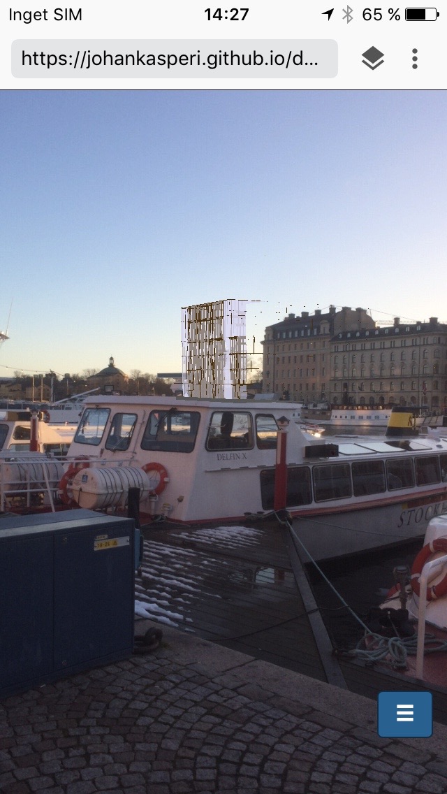
Adds OSM building data to argon.js for occlusion with real world buildings. This module queries the Overpass API for OSM building data, it then converts it to transparent three.js meshes and adds it to your argon.js scene.
Demo
Occlusion deactivated
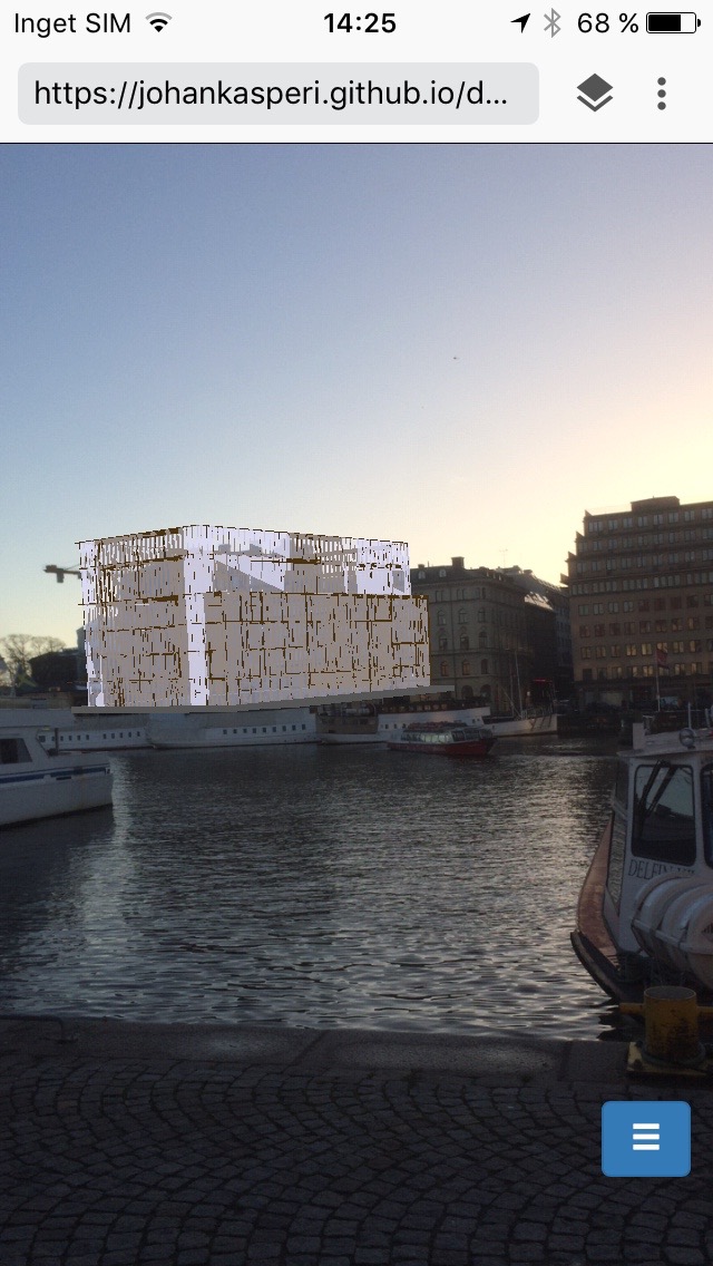
Occlusion activated
Status
The state of this module is very experimental. It needs further development and testing before being used in production.
Usage
Installation:
$ npm install argon-osm-occlusion --saveUsage:
import ArgonOsmOcclusion from 'argon-osm-occlusion'

var app = Argon.init();
var scene = new THREE.Scene();

var argonOsmOcclusion = new ArgonOsmOcclusion(app, scene);
argonOsmOcclusion.add({
  longitude: 59.347457,
  latitude: 18.073780
});var mesh = new THREE.Mesh(geometry, material)
mesh.renderOrder = 2API
ArgonOsmOcclusion(app, scene)
The main class for handling all occlusion,
app: Your argon.js app.scene: Your three.js scene.
Properties
featureGroups
Array of all feature groups added to the scene. A feature group has the properties:
id: Id of the group.name: Name of the group.longitude: Longitude of the bounding circle center.latitude: Latitude of the bounding circle center.altitude: Altitude of the added buildings.radius: Radius of the bounding circle.features: Array of all the buildings containing its geolocation data.geoObjects: Array of all the three.js objects created from the OSM data, i.e. all the buildings in this bounding circle.geoEntities: Array of all the Argon.Cesium.Entity created for each building.
Methods
add(options, callback)
Queries the Overpass API for OSM building features, converts them to three.js meshes and adds them to the scene.
options: This method takes the following options:
longitude: Float. Longitude of the bounding circle center used when querying the Overpass API. Required.
latitude: Float. Latitude of the bounding circle center used when querying the Overpass API. Required.
altitude: Float. Altitude (in meters) above the ellipsoid of the added buildings. Default 0. Optional.
radius: Float. The radius (in meters) of the bounding circle. All buildings within this radius from the longitude/latitude coordinate will be added to the scene. Default 500. Optional.
name: String. Name of this feature group. Default null. Optional.
levels: Fallback for the "building:levels" property. Many buildings in OSM don't have any "building:levels" property reported. And it's this property who determines the height of the three.js objects added to the scene. Read more at Key:building:levels. Default 3. Optional.callback: Function. Callback returning either error or the id of the created feature group. Optional. Example:
argonOsmOcclusion.add({
  longitude: 59.347457,
  latitude: 18.073780
}, function(error, id) {
  if(error) {
    throw error;
  } else {
    featureGroups.push(id)
  }
});
remove(id)
Removes all three.js objects associated with the provided feature group id from the scene.
id: Int. Id of the feature group to be removed.
removeAll()
Removes all feature groups from the scene.
disable(id)
Disables (hides) all three.js objects associated with the provided feature group id from the scene.
id: Int. Id of the feature group to be removed.
enable(id)
Enables (shows) all three.js objects associated with the provided feature group id from the scene.
id: Int. Id of the feature group to be removed.
setDebug(debug)
If debug is true it make all added three.js buildings opaque (with a blue color) for debugging purposes. If false it will make them transparent again.
debug: Bool.
- Support for more advanced roof shapes. Currently is all roofs flat. (see OSM-4D/Roof table)
- Performance testing.
Johan Kasperi
kspri.se
Part of my Master Thesis at the Royal Institute of Technology